Is 3 rivers a navigable river or not?

if the craft makes it down with out capsizing its navigatble ???????????
 
Navigable.... What does this really mean to us as fishermen? If a river is not navigable land owners with river / creeks on their land own the bottom. This means you can't walk or drop anchor on their land without trespassing. But, you can float on the water . .. they can't keep you from doing that. The problem with Three rivers is you can't fish from a floating device. It's my understanding that these laws were pushed through by some land owners below Cedar Creek to keep people from fishing the water on their land. I have also been told that if you stay in the water and get a ticket for trespassing there isn't a judge in Oregon that would rule against you. With all that said do you really want to get into a legal matter with a land owner that knows powerful people? One powerful enough to get a regulation changed in his favor?
 
I have an issue with that section of river... mainly because we fund the fish that that land owner has exclusive rights all to themselves. That just doesn't seem right. Seems as though a land owner on a river that has a hatchery above it, should not be allowed to "own" a section of water between that hatchery and the ocean... just sayin'.
Am I off base on this? I fish several rivers that fit this bill and its not right...
(sorry, got off topic there)
 
Last edited:
Nope, thing you just hit a home run. Money and power always wins or what is right. Or makes sense for that matter.
 
So looking at google earth, is there some of 3 rivers that is on forest land? Just below the hatchery? Looks like a campsite area also. I'm thinking this might be public access point?
 
skunk said:
So looking at google earth, is there some of 3 rivers that is on forest land? Just below the hatchery? Looks like a campsite area also. I'm thinking this might be public access point?

well, when i went there for springers there were people lined up in the water as far as i could see below the hatchery and there are trails along the woods so id say yeah
 
trespassing tickets

trespassing tickets

Instead of just proving the navigability of the reach where you got a ticket, how about suing the landowner and agency involved for false arrest? Otherwise the landowners will keep treating the river as his property and calling the cops who will oblige him since he has the power and authority of being a resident property holder. It's time to put a stop to the intimidation. Too many of us are avoiding certain reaches because the landowner is a "dick."
 
I believe in situations where the land owner owns property on both sides of the stream, if its non navigable, then he owns the land under the water.
 
I know for a fact the Scott Amerman has drifted, in a drift boat, from the bridge at the hatchery down. It was in winter, several years ago.
I asked the state cop last year if I could walk down since it was navigable. He told me it wasn't. So I asked, if it's not, why is there a law stating you can't fish from a boat. Doesn't that law imply it is indeed navigable? He said that was a logical point. He said he would ask around, but that I would be better off asking the judge or consulting an attorney. I may try it later this month.
 
Heres a post by Osmosis, on SSSF.


Navigable rivers/sloughs in Oregon.

Though there is much to be debated regarding the rationality behind what is navigable and not, here is the current (as far as I know) list of the ones that are considered navigable.
There are several rivers listed as Navigable on a state level, very few actualy - which is odd considering how many rivers have state funded boat ramps. There are however around 100 that are listed as federally navigable.

There is a loophole I keep hearing about, to the effect of: rivers with state funded ramps are deemed navigable between such ramp and the takeout, Not sure of the validity as I can't find a law written on it.

On a state level these are Navigable:
Chetco,
Columbia,
Coos,
Coquille,
John Day,
Klamath,
Mckenzie,
Rogue,
Sandy,
Snake,
Umpqua
Willamette.


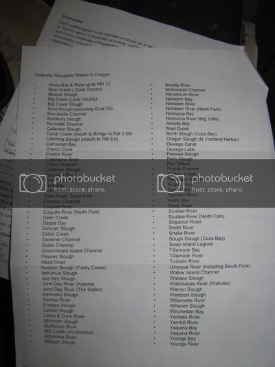
Federally navigable waters in Oregon:

alsea bay & river to RM 13
bear creek (coos)
beaver slough
big creek (lane)
big creek slough
blind slough (including gnat creek)
bonneville channel
bradbury slough
burnside channel
calandar slough
canal creek (mouth to bridge to RM .06)
catching slough (mouth to RM 6)
cathlamet bay
chetco cove
chetco river
clatskanie river
clifton channel
coalbank slough
columbia river
columbia slough
coos bay
coos river
coos river south fork
cooston channel
coquille river
coquille river north fork
dean creek
depoe bay
duncan slough
eslick creek
gardiner channel
goble channel
government island channel
haynes slough
hood river
hudson slough (farey creek)
isthumus slough
joe ney slough
john day river (astoria)
john day river (the dalles)
kentucky slough
kilches river
knappa slough
larson slough
lewis and clark river
mcintosh slough
mckenzie river
mill creek (on umpqua)
millicoma river
millport slough
molalla river
multnomah channel
necanicum river
nehalem bay
nehalem river
nehalem river (north fork)
nestucca bay
nestucca river (big and little)
netarts bay
noel creek
north slough (coos)
oregon slough (N portland harbor)
oswego canal
oswego lake
palouse slough
port orford
prairie channel
pulaski creek
randolph slough
rogue river
sand lake
santiam river
siletz bay
siletz river
siuslaw river
siuslaw river (north fork)
skipanon river
smith river
snake river
sough slough (coos)
swan island lagoon
tillamook bay
tillamook river
tualatin river
umpqua river (including south fork)
walker island channel
wallace slough
wallooskee river (walluski)
warren slough
westport slough
willamette river
willanch slough
winchester bay
yachats river
yamhill river
yaquina bay
yaquina river
youngs bay
youngs river
food.jpg
 

Similar threads

S
Replies
15
Views
671
TheKnigit
TheKnigit
bass
Replies
1
Views
1K
fromthelogo
fromthelogo
bass
Replies
6
Views
3K
Casting Call
Casting Call
troutdude
Replies
5
Views
2K
fish face
F
troutdude
Replies
6
Views
2K
playhooky
P
Back
Top Bottom